|
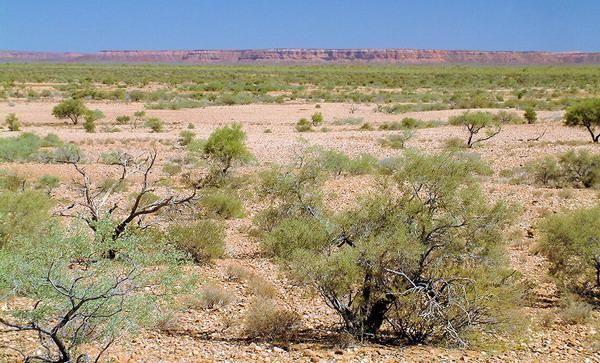
Located in the Gascoyne region around 160 kilometres inland, the Kennedy Range is on the edge of the Gascoyne River's catchment area.
Some 250 million years ago the area was under the sea and today it is rich in fossils of marine animals. The range is between 10 and 25 kilometres wide
and extends to the north from the river catchment for 195 kilometres.
The range is spectacular (in places) and there are a wide variety of wildflowers (around 80 species) in the park. Animal life is also abundant with small
kangaroo species being the most visible but interestingly there are also 9 species of bat known to live in the area and 33 reptile species. Over 100 species of
birds have been seen here too.
One of the problems in the park comes from feral goats and in 2007, 1800 goats were removed from the park.
Francis Gregory named the range in 1858 after the then Governor of the
state, Arthur Edward Kennedy. In his report on the area, Gregory said the
following:
"With regard to the quantity and distribution of the available lands, it will only be necessary to observe that, with the exception of 30,000 or 40,000 acres at the
mouth of the Gascoyne, there is no land worth occupying for many years to come to the west of the Lyons River; the amount of land on this river has already
been estimated at nearly 300 square miles, while on the Upper Gascoyne and its tributaries there is probably double that quantity; this, with the lands on the
Murchison near Mount Hale, would make a total of about a million of acres.
A very important circumstance in connection with this district is the total absence, so far as we were able to observe, of any of the varieties of gastrolobium or
euphorbia, which constitute the poisonous plants so fatal to cattle and sheep in other parts of the colony.
The means of access to the Upper Gascoyne and Lyons is another important matter for consideration. I am inclined to think that this district cannot be advantageously
settled until the tract of country between it and the north coast has been explored, and a port established somewhere between Exmouth Gulf and Depuch Island, as,
should the country in that direction fulfil its promise, the intervening space would very quickly be filled up, and the lands on the Gascoyne become available, its distance
from the north coast being about 200 miles, while from Port Gregory or Champion Bay would not be less than from 340 to 360 miles--a difference of some moment in
the transport of stores or produce.
From the lay of the country to the northward of the Lyons River there does not appear to be any reason to suppose that a river of any magnitude falls into Exmouth
Gulf, as there would be hardly room for it between the sources of the Alma and the rivers flowing to the north coast."
The range was important to the Aboriginal people as springs and permanent waterholes are scattered along the base of the hills and this water source also attracted
European settlers to the area. The lack of poison plants, as mentioned by Gregory, would have been another important factor in attracting pastoralists to the area.
Although sheep stations were established in the vicinity starting from 1878, the area now occupied by the National Park remained relatively undisturbed due to the lack
of water. Average annual rainfall in the area id 210mm with the wettest month being February but the top of the range is particularly dry and this has kept it relatively
undisturbed.
80 kilometres of the range is a huge mesa, pushed up from an ancient sea bed. About 250 million years ago the area was a shallow ocean basin on the edge of
Australian continent. It slowly filled with layers of sediment and this was compressed by the weight of successive layers. Much later It was raised above sea level
and over time erosion from wind and water has stripped away much of the rock leaving canyons, cliffs and gorges. Fossils found in the range not only include
marine animals but also plant species.
On top of the mesa there are red sand dunes that were formed by the weathering of the sandstone beneath.
The park was first gazetted on 8th January 1993 and has continued to expand as properties are acquired. An extra 177,377 Ha of land were earmarked for incorporation
into the national park in 2001.
Although access to the eastern escarpment is ok for 2 wheel drive vehicles, access to the western side of the park is best suited to well prepared 4 wheel drives.
Opalite, Mookarite, Chalcedoney, Petrified Wood and fossils are found in the area and attract gem collectors.
There are two walk trails, one from the Temple Gorge campsite and one from the visitor's area on the northern side.

(C) Max Jefferies
NPW Website for more information
Best time to visit:
|
Jan
|
Feb
|
Mar
|
Apr
|
May
|
Jun
|
Jul
|
Aug
|
Sep
|
Oct
|
Nov
|
Dec
|
|


