DESCRIPTION
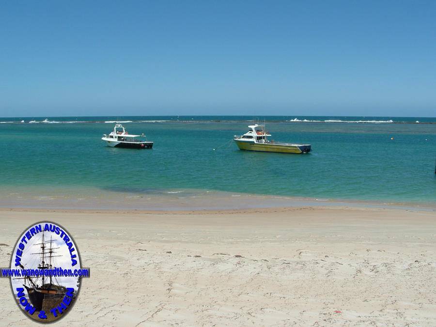
Port Gregory (or just Gregory as it is now known) is located near the mouth of Hutt River (named after William Hutt *), the town supports a small fishing industry.
The town in 47km north west of Northampton and an offshore reef provides a safe anchorage. Safe that is, once you are behind the reef, but between
1853 and 1867 at least six vessels struck the reef and sank.
The coastline is picturesque but the town remains mostly undeveloped. It is often overlooked by tourists in favour of the much better known town of Kalbarri.
* John Hutt (W.A.s second Governor) had a brother called William who was involved in
establishing South Australia. The river was named in his honour by George Grey as he
passed through the area on his epic walk to Perth.
Lynton convict depot.
This is the most intact convict hiring depot remaining in Western Australia. It is located a few kilometres south east of Port Gregory and is open to the public as is the nearby Sanford Homestead.
The convict depot was opened in 1853 and convicts from here were taken to work the lead mines 40 miles north east at Geraldine.
The depot did not survive due to the difficulties associated with living in the area and the lack of transport.
Just 500m from the depot is Captain Sanford's house, stables and mill. These buildings are slowly being restored and they provide a marked contrast to how the convicts and their pensioner guards had to live just out of sight around the hill.
The timber used in Stanford's house was mostly salvaged from flotsam washed up on the beach. The supporting beams along the balcony were once the masts of sailing ships.
Pink Lake
Pink lakes are fairly common on the West Australian coast but not all live up to their names. This one, however does. The pink colour is due to the presence of Dunaliella salina, a bacteria that lives in the salt deposits. The bacteria is a source of beta carotene which is extracted from the lake by a commercial operation.
Lancome Australia photographed a model lying in the pink salt lake to promote a new range of lipstick.
HISTORY
First established in 1853 as a port for shipping lead from the Geraldine Mine, there was also an attempt to establish a labour depot in the area where 'ticket of leave' men would be hired out to
local farmers. This did not meet with much success and was later abandoned. The legacy of the convicts lives on in the buildings they constructed while there were there. The Superintendent
of the of the depot (H.A. Sanford) settled in the area taking up land and building Lynton homestead. The settlement still exists and is open to the public.
Gazetted as Pakington in 1853 (after the secretary of state, John Pakington) it was locally known as Port Gregory - in honour of
Francis and
Augustus Gregory - the townsite was re-named Gregory in 1967 but most people
still refer to it as Port Gregory.
TALL TALES AND TRUE
No information for this section yet. If you know of something we can add here please contact us and let us know.
VIDEO
PROBLEM PLAYING THESE ON FIREFOX?
Turn off Enhanced Tracking Protection
Click the shield icon left of the URL near the top left
Slide Advanced Tracking Protection to OFF
(C) aussieheliadventure YouTube
OTHER INFORMATION
ATTRACTIONS
Pink Lake, Hutt Lagoon, Lynton convict depot, Sanford homestead.
BUILDINGS OF NOTE
Unknown.
ELECTORAL ZONES
State : Moore
Federal : Durack
OTHER INFO.
Postcode : 6535
Local Government : Shire of Northampton
PHOTOS
Click on a thumbnail to see full sized picture.
Please note that using the https url will cause the photos not to show. To show photos use the standard http url.


