DESCRIPTION
A nearby tree covered red rock monolith, Mingenew Hill, gave the town its name although another source quotes a freshwater spring as the source of the name.
The word 'mininoo' (also quoted as 'Mengenew' and 'Mingenoo') is said to mean
'place of many waters'. This is one possible origin of the town name. It may refer to the fairly frequent flooding of the rivers after heavy rain.
Another source quotes the Aboriginal word 'minganu' meaning ant's nest as a possible source of the name.
Cyclones in the north west often become large rain bearing depressions and travel south over this district dumping large quantities of rain. Bridges, roads and even houses
are sometimes washed away during these storms.
The area is most popular with visitors during wildflower season (August-September).
HISTORY
The area was first explored by the Gregory brothers in 1846. It is a wheat and
sheep town that was established in the 1880s.
The first settlers (Edward Hamersley and Samuel Pole Phillips) took up leases in 1850 but the area was to remain sparsely populated for quite some time.
Township lots were privately sub-divided in 1891 by Samuel James Phillips (one source says 1890) and in 1906 adjacent land was sub-divided by the government. A year
later the private land was also incorporated into the townsite. (Another source states that the town was recognised by the Government in 1912 but as it was gazetted in 1906
we are unsure as to what the 1912 date relates to.) This was bad news for the two hotels because up to that time they had only been paying 15 pounds a year in Government
license fees, with gazettal they had to cough up 50 pounds a year.
Coal was discovered in 1846 but it proved to be poor quality. It would burn quite happily but left a large quantity of soot that made it useless for most applications. Rocks in
the area contain a large number of marine fossils which are reported to be as much as 250 million years old.
Traces of gold were found in the area in 1870 and it caused a minor gold rush but it was quickly discovered that there was very little payable gold and hopeful miners moved
on to other areas. Even so some of the mining leases were worked until 1900. Copper was also found but again proved not to be payable.
Early livestock breeding did not include sheep as there were a high number of dingos in the area. By 1870 settlement was progressing and sheep were then brought in to be
bred alongside the existing herds of cattle.
Transport problems for farmers were eased with the opening of the rail line to Midland in 1894 (other sources say 1891 and 1897).
For quite a small town, Mingenew provided more than its fair share of soldiers for both world wars with some 287 enlistments.
TALL TALES AND TRUE
No information for this section yet. If you know of something we can add here please contact us and let us know.
VIDEO
PROBLEM PLAYING THESE ON FIREFOX?
Turn off Enhanced Tracking Protection
Click the shield icon left of the URL near the top left
Slide Advanced Tracking Protection to OFF
OTHER INFORMATION
ATTRACTIONS
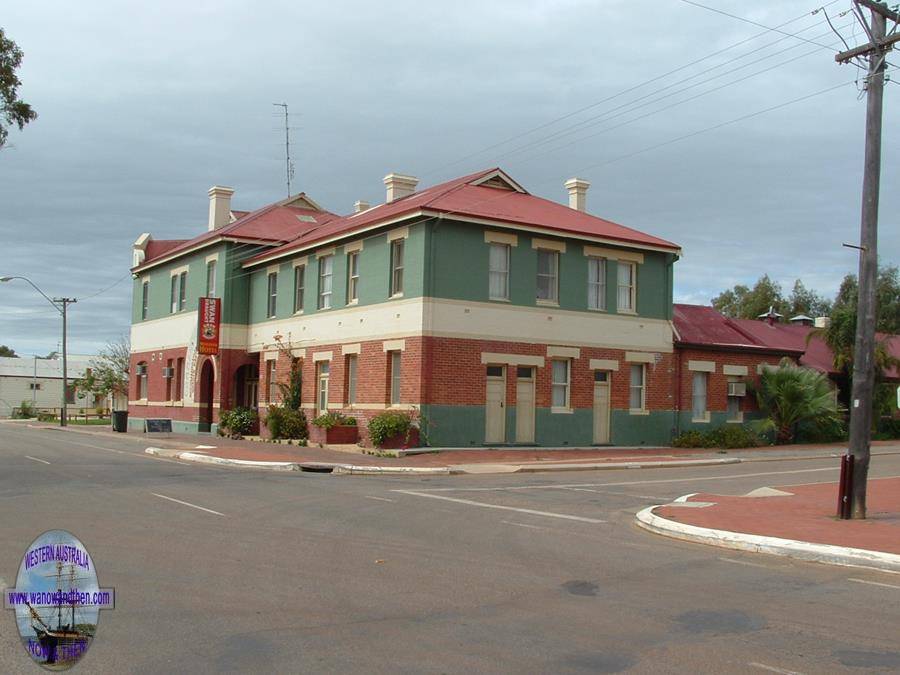
Mingenew Hill, Depot Hill, Spelling mistake on the local hotel, Museum, Cecil Newton Park, The Mingenew Common Wildflower Walk, Coalseam NP, Murals,
USN tracking station, Grain centre, Mingenew Springs, Drovers Rest.
BUILDINGS OF NOTE
Bundanoon 1880s, Former Road Board office 1906, St. Joseph's presbytery 1900, Police residence 1898, Railway Station 1894, Post office 1894, Enanty Barn.
ELECTORAL ZONES
State : Moore
Federal : Durack
OTHER INFO.
Postcode : 6522
Local Government : Shire of Mingenew
PHOTOS
Click on a thumbnail to see full sized picture.
Please note that using the https url will cause the photos not to show. To show photos use the standard http url.


