|
After yet another trip to the workshop costing $1075 we got the Coaster back and packed very quickly.
The autumn weather was perfect with warm days and cool nights so we wanted to make the most of it while it lasted.
After just one day packing, which must be a record for us, we hit the road and made our way through the surprisingly light Saturday morning traffic to the Great Eastern Highway
and headed up Greenmount Hill.
The plan for this trip was to make our way along the Great Eastern as far as Southern Cross but to take as many interesting detours as we could along the way.
Our first planned stop was the little town of Meckering.
Meckering is most famous for being close to the epicentre of an earthquake that occurred in 1968.
Many buildings were destroyed in the quake and the town went from being quite an important rural centre, to being a very quiet sleepy place.
Travellers passing by can stop overnight at a rest area in town. Toilets, seats, shelters and BBQs are available and you can leave a donation to assist with costs.

Meckering 24 hour rest stop
We wandered in to a shop at the bottom of the street and found it was a brand new business opening in the town.
Coltons is hard to classify exactly but my best attempt is to call it a cafe with plenty of extras.
Apart from very tempting home made ice cream, cakes and other assorted goodies there are are range of home-made scented candles, candle melts, bath products, soaps
and even locally made beef jerky.
There are other assorted products that you can only buy at the store and for those with pets, there is a great range of dog food, chews etc.
While you sit and enjoy coffee and cake you can play a game of scrabble or cards. A nice relaxing stop if you are just passing thorough or a great place for something more if you want to stop overnight.
We picked up some scented candles and candle melts and came back later to try some cake and ice cream.
We can highly recommend the products and it is well worth having a look if you are near Meckering.
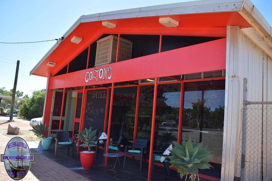
Coltons - Meckering
We also visited the camera museum. This is also something quite special and you won't find anything else like it in W.A.
The camera collection is astounding and dates from the very early models to some of the more up-to-date cameras.
As you wander around the shelves stacked with cameras there is the chance to listen to interesting commentary on the history of camera design and you can find out more about how the
instant Polaroid cameras were developed and even how Kodak got its name.
All the equipment on display is in working order and to find such an amazing display is such a small, out of the way place, was quite a surprise.
The entry fee of $12 we found was a bit on the high side but then there may not be that many visitors and overheads do have to be paid.
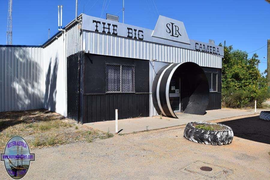
The Big Camera - Museum
The next day it was a short 22km hop to the larger town of Cunderdin.
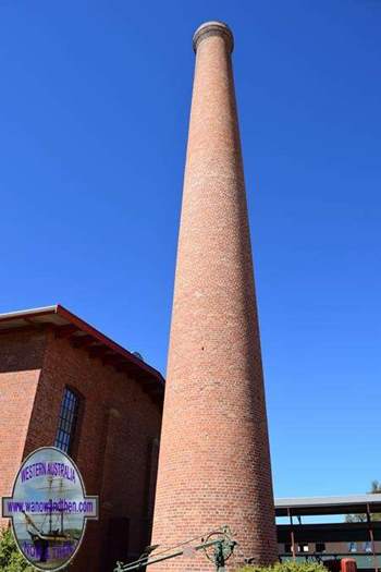
The Pumphouse Museum is one of the most interesting attractions in town so we went to have a look at that first.
The collection of old vehicles with a biplane, railway carriage and assorted war memorabilia is housed in what used to be one of the pump houses along the water pipeline from
Mundaring to Kalgoorlie.
One of the most interesting experiences in the museum is the 'earthquake house'. The house is built on a motorised platform that recreates the feeling of being in an actual
earthquake. It is quite a surprise when everything starts to shake and the floor moves under your feet.
Thankfully this structure is purpose built and unlike a real earthquake, there is no danger of the house collapsing on top of you.

Pumphouse Museum
After doing some more filming and photography around town we headed south to Youngedin.
Along the old Goldfields road we found an old farmhouse ruin and further east was a building that was once used as a police station.
This is still remarkably intact and open for people to wander through. It was nice to see it being so well preserved and also nice to see that it had not been vandalised.
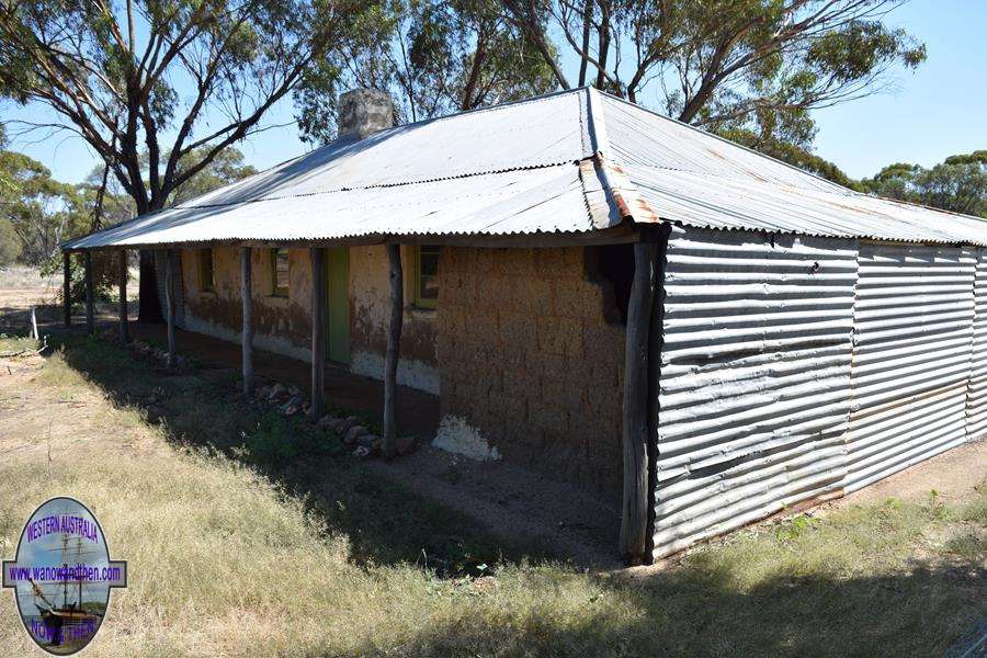
Youngedin
We continued along Goldfields Road to the site of Hunt's Well. This was once an important water pick up point on the long trek to the goldfields.
It was quiet and we decided to stop for the night before heading into Tammin the next day.
Being so close to town there was good phone signal here.
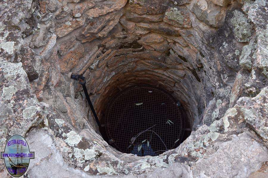
Hunt's Well
After a lovely quiet night at Hunt's Well we drove just a few kilometres north to Tammin. Tammin isn't a large town but we spent some time getting some up-to-date pictures and footage
before heading north to Yorkakine Rock.
The rock looked interesting enough but the parking bay was rather small and there were NO CAMPING signs so we took some pictures and turned east along Yorkakine Road heading for Burges
Spring. We had hoped that this would make a good overnight stop but it turned out to be pretty ordinary and although we could have stopped we decided to keep going.

Yorkakine Rock
We turned south and headed to Kellerberrin where we fuelled up and were able to pick up some water and dump our black waste at the shire caravan park.
We did take the opportunity to drive up Kellerberrin Hill to the lookout but as we had seen the town before we didn't linger too long.
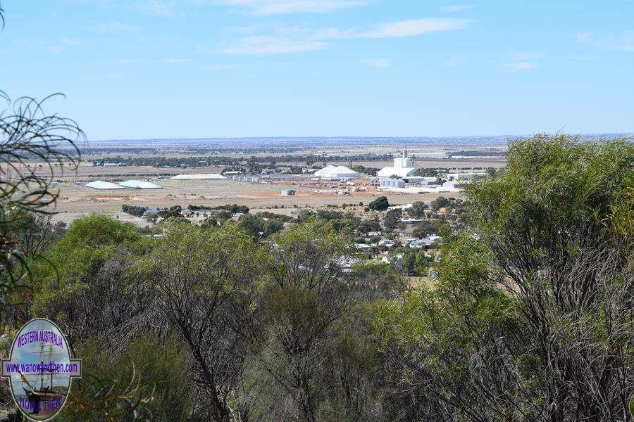
Kellerberrin Hill
We travelled east along the Great Eastern Highway to Mission Road where we turned north and after driving a few kilometres we found a good overnight stop at Mooranoppin Nature Reserve.
This isn't signposted but a track leading west (left) just north of Goldfields Road, leads to what was once a toilet block and a shelter. Both are clearly visible from the road.
There were once solar hot water showers here but the block had been vandalised and now no useable facilities besides the shelter remain.
It was a great place to overnight but the flies were pretty terrible so before setting up the BBQ we set up our OzTrail insect proof shelter.
Despite being not that far from Kellerberrin, we didn't get a phone signal here.
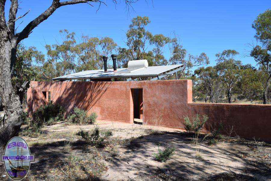
Mooranoppin Nature Reserve
Another lovely quiet night and being able to sit outside without being pestered by flies and eaten by mozzies was an added bonus. We will have to make use of the 'gazebo' more often.
We moved on to Doodlakine and took the usual video and photographs and then continued east to Hines Hill. The open area near a salt lake that I had hoped would turn out to be a good rest
stop turned out to be an old rubbish tip and it was closed off so we had to keep going. Not everything we find on Google Earth turns out to be a good place to stop.
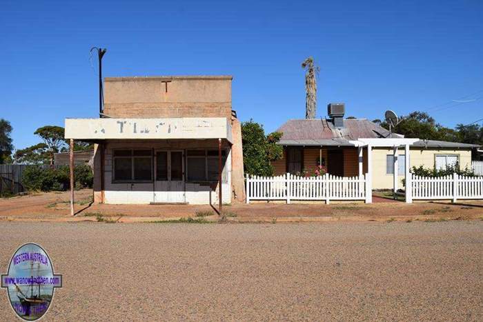
Doodlakine
We followed Hines Hill Rd. North to Baird Rd. and went in to have a look at Danberrin Rock. It turned out to be a good spot to stay overnight as there were seats, tables and a toilet so we
stopped early and set about doing some 'household' chores such as downloading pics and recharging batteries.
We didn't expect it but there was a phone signal here.

Danberrin Rock
The flies were driving us potty and I resorted to using a fly net on my hat to keep them away from my face. As the weather was staying warm there wasn't much chance of any relief.
We continued north to Nungarin and refuelled and filled our water tanks (there is a tap on the side of the public toilets).
We saw the local museum on a previous trip to the town but the video camera had broken down so we went back again to get some video footage.
The museum should be more widely publicised as it is a real treasure trove of farming and military equipment.
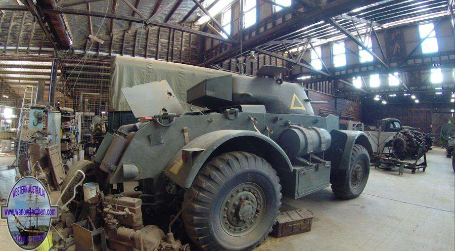
Nungarin Military Museum
Continuing north we reached Lake Brown (Eaglestone Rock) where there is a campsite.
The road in is unsealed but in good condition. The campsite is signposted at a 90 degree bend. Continue on to the smaller track to reach the camp and lake.
The first area we reached wasn't the main campsite, to reach that you have to follow the main track for another 3km.
It is a nice big site by the side of the lake but when we were there the lake was bone dry.
There is a toilet but for some reason it has been situated away from the campsite on a side track as you come in.
There is plenty of room for all sizes of rigs and there is some shade.
We didn't manage to get a phone signal here but as it is quite a distance from the nearest town that wasn't a surprise.
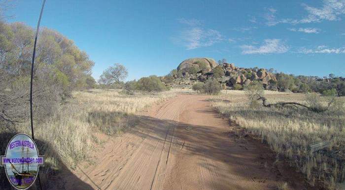
Eaglestone Rock
Continued north to Mukinbudin to pick up fuel for the generator and some supplies from the local IGA store.
We didn't need to pick up water here but for anyone who does, there is a tap at the public toilets on the main street across the road from the shops.
We dropped in to the second hand book store again and managed to pick up some good historic books about W.A.

Mukinbudin book store
Turned east on the Bullfinch road and made our way towards Baladjie Rock.
Along the way we noted two rest areas. One was not far out of Mukka at Pope's Hill. Large open area suitable for all rigs but nothing notable other than its historic significance.
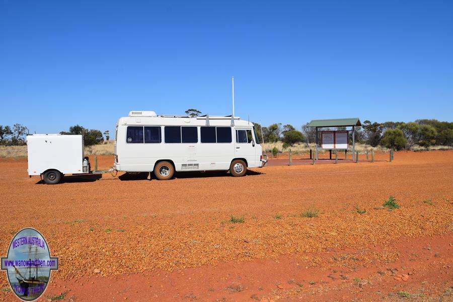
Pope's Hill Rest Area
The next rest area was at Weira Nature Reserve just west of Stock Road on the south side of the road. Again nothing special to note about this stop.
Stopped for a quick look at Warralakin. There isn't much but a grain silo, hall and a couple of houses. Looks like someone was a bit desperate to use the dunny as the locked door had been torn
off and a pretty solid metal door it was too!

Warralakin
We kept heading east to the turn off to Baladjie Rock. The track in is NOT a wet weather track. Stay away if rain is forecast or you might get trapped. A long section of road looks like it gets very
boggy when wet.
The campsite by the rock has no facilities but it is big and can handle just about any rig. Big rigs will have to watch for overhanging branches.
As with Eaglestone Rock, the nearby salt lake was dry.
There are a couple more campsites located further around the rock past the lake. The track going round was good but this would be another one to be careful of in wet weather.
No phone signal here either.

Baladjie Rock
Cloud had moved in overnight so we decided not to hang around in case it rained and the track got boggy.
We made our way to Bullfinch (the road from Mukinbudin to Bullfinch looks quite new and is sealed and very good).
Bullfinch is a bit of a frontier town with a number of ruined buildings and a heap of old cars scattered around.
It was interesting enough to take some pictures of but not interesting enough for us to stay very long. We had intended to head a bit north of town as there are some ruins out
that way but with the chance of rain we didn't want to get stuck as it is all unsealed roads of unknown quality.
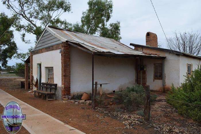
Bullfinch
We turned south and 35km later arrived at Southern Cross.
'The Cross' is quite a large town with good facilities. We would have expected a better supermarket considering the number of people in town and prices for fruit and veg were VERY high.
As we had managed to arrive on Good Friday, most places were closed but there is a 24 hour rest area near town and we decided to stay the night.

Southern Cross
The actual rest area is on the corner of Great Eastern Hwy and Three Boys Road. It is located on a slope and is very uneven. A track leading out the back of the rest area led us to a better site
and we were further from the main road and associated noise.
Southern Cross is a nice tidy attractive town and has a number of interesting old buildings.
There is a black water dump point by the recreation ground and a water tap is located on the rear corner of the Community Centre.
Phone signal is good in town - as you would expect.
A peaceful enough night ended abruptly at 6am when mining machinery not far away started up. We got going and dropped into town to pick up water and fuel and to get rid of black waste.

Southern Cross 24 hour rest stop
We turned west for the first time this trip and passed through Moorine Rock. The tiny town is on the Great Eastern Highway but there is an actual rock 12km north west
along the unsealed (but good condition) Noongar Road.
There is plenty of room to park near the rock and another one of Hunt's wells along what was once the main track to the goldfields. Hunt quickly realised the importance of granite outcrops
as sources of water and many of the wells he constructed are located near a series of these rocks.
There are no facilities at the rock but we did manage to get internet by using an aerial.

Moorine Rock
Our next destination was Westonia. This is a delightful little town located a little north of the Great Eastern Highway and you turn off at
Carrabin.
We dropped in once before on our way to the Goldfields but this time we stopped overnight at the free 48 hour rest stop (for self-contained vehicles).
The town has a very interesting museum and facilities for the locals are pretty good including a large sporting facility, recreation centre, lawn bowls, swimming pool etc.
On occasion there is a siren followed shortly afterward by a large rumble as explosives in the Edna May Mine are detonated but it is a fairly rare event and is of no
concern.
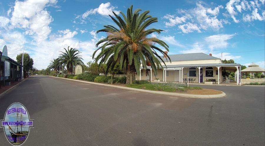
Westonia
The town is also one of the most attractive in the state and is well worth a visit.
Close to town is the Edna May mine lookout where you can see the working open cut mine and there are a number of reserves within easy reach.
There is also good phone signal in town.

Edna May mine
As the rest stop is Westonia was 48 hour we did a bit of exploring, going out to Sandford Rocks where there is a bird hide (probably a much better place after recent rains have replenished
water sources next to the rocks) and then went to have a look at Edna May Mine.
We found the black-water dump point located a little out of town past the Edna May Mine lookout road.
As it was a public holiday there wasn't much else to do except relax.

Sandford Rocks
Next morning I went to have a look at the Hood-Penn museum located next to the shire office. Entrance is via the shire office.
Although I had visited the last time we were in town I wanted to get some footage and it was worth coming again as some of the exhibits had changed.
Entry to the museum is only $3 (at the time of writing) and it is a very interesting collection.
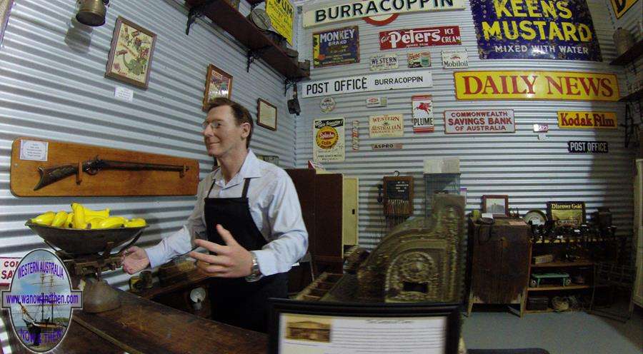
Hood-Penn museum
Then it was off to Merredin with a stop-off at Burracoppin along the way.
There isn't a great deal to see at Burracoppin besides the hotel but there is a nice area located along Burracoppin North Road just across the railway crossing.
There is a large open area with trees, a dam and an old house ruin that would make an excellent overnight stop. There are many track around the dam so it would
be wise to park and walk them first if you want to park close to the water.

Burracoppin
We had already decided to keep going to Merredin where there is a 24 hour rest stop located just south of Merredin Peak.
The rest stop can be found via Mitchell St., Telfer Ave. and Benson Road.
It is only for self-contained vehicles but it is a nice area.

Merredin 24 hour rest stop
Before heading out to the rest area we stocked up on supplies and then had a look at the very interesting railway museum located at the old station.
There are a number of exhibits but two of the most interesting were the signal box and an underground cellar.

Merredin Railway Museum
We also intended to visit the military museum next door but a large thunder storm rolled into town and we decided to call it quits for the day and come back the next morning.
This turned out to be a mistake as overnight a personal crisis developed and the trip came to an abrupt and as we had to head home quickly.
The trip was pretty good overall. The Coaster behaved itself perfectly (for a change) and we did get to film and photograph most of the places we wanted to see. There are such
a variety of places in this area of the Wheatbelt that it will take at least a couple more trips before we have seen everything we would like to visit.
Updated April 2017


|


