|
MACE'S FIND
Later known as DAVYHURST.
MAHOGANY FLATS POLICE STATION
Also called 36 MILE POLICE STATION.
MAINLAND
27 35' S 117 55' E
Located on the north shore of Lake Austin 15 km south of Cue
The name was given to distinguish this settlement from The Island.
Gold was discovered in 1892 and the town site was gazetted in 1898.
MALCOLM
Originally called Mount Malcolm
28 56' S 121 31' E
20 km east of Leonora on the Laverton road.
Gold discovered 1895-6
The name is from the nearby Mount Malcolm named by John Forrest in 1869 after
Malcolm Hamersley who was with Forrest.
The town site was gazetted in 1897
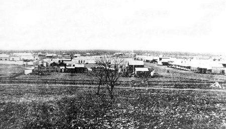
In 1900 there were a number of stone buildings in the town. Kerosene street lamps were in use and there was even a swimming pool.
In 1903 there were 210 buildings in the town and the population reached 450.


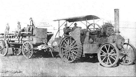
Steam traction engine

Mechanics Institute
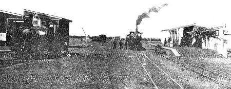
Railway
MALLINA
20 53' S 118 02' E
Located between Roebourne and Port Hedland.
Gold discovered in 1887 by Jimmy Withnell.
The population in 1890 was 120.
Townsite gazetted in 1896.
MANGOWINE
31 2' S 118 5.5' E
North of Nungarin
Charles Frederick Adams took up residence in 1874.
MANINGA
No details.
MARLEY
30 km from Sandstone.
Gold discovered 1903 by E. Arundal and M. Dwyer.
Continued to operate until 1927.
MARCHAGEE
30 03' S 116 04' E
23 km south of Coorow.
Reserve for travellers declared in 1876.
Townsite gazetted in 1927.
MARRADONG
301 km south west of Perth near the Williams district.
There is still a church and the odd farmhouse here but no other signs of the old settlement.

MARRANUP
Alternate spelling of MARRINUP.
MARRINUP P.O.W. CAMP
Located near the sites listed below, this was a prisoner of war camp during World War II.
There isn't much left here now but some old foundations.

MARRINUP RAILWAY SIDING
32 42.2' S 116 1.6' E
Located on the Pinjarra to Dwellingup railway.
MARRINUP TIMBER MILL
North side of Marrinup Brook 5 km west of Dwellingup
Operated from about 1910 to 1936 with some periods of closure between.
The site is now a popular camping area.

MARYVALE
Operated by the W.A. TIMBER CO. from 1870 to 1888.
It had a rail line and jetty at Wonnerup, and the now famous train "The Ballarat".
The train ran from the coast deep into the Jarrah forest, on an unusual set of rail tracks that were actually a flat
steel strip plate (See picture) that was nailed to timbers that were
fastened to the sleepers.
The town was constructed on the edge of the Ludlow river, and there were over twenty buildings and a very deep
well, presumably for summer time when the river dries up.
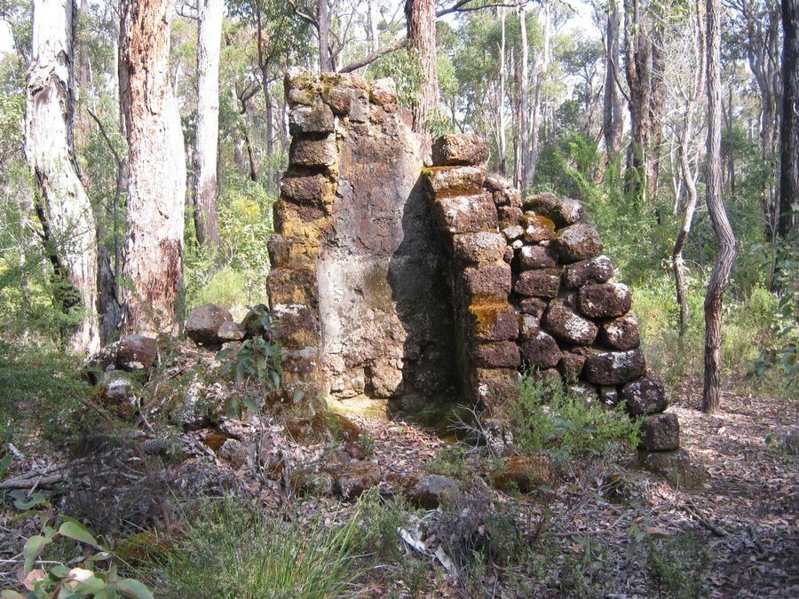
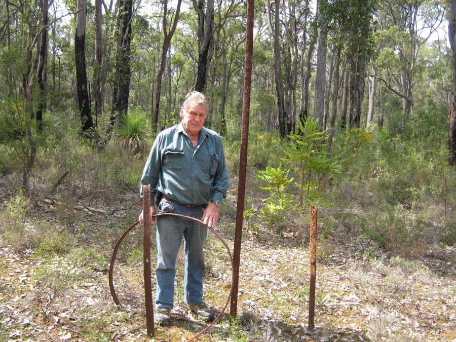
Thanks to Rex Barber for the information and pics of Maryvale.
MAYA
Previously known as POCANMAYA.
29 53' S 116 30' E
Located on the railway between Wubin and Latham.
Gazetted in 1913.
MELITA
Located on railway between Menzies and MALCOLM.
MELVILLE
Early name for NOONGAL.
MEROLIA
Early name for BURTVILLE.
MERTONDALE
28 40' S 121 32' E
29 km north east of Leonora.
Gold discovered in 1898 by Fred Merton.
Townsite gazetted in 1899.
Abandoned by 1910.
MESSENGERS PATCH
46 km south of Yalgoo.
Alf Messenger was the first to find gold here.
MILLBROOK RAILWAY SIDING
Located on the Brunswick to Collie railway but the exact location is unsure.
Timber Mill built by William Atkins.
Abandoned by 1924.
MOIR HOMESTEAD
Located in Stokes National Park, near Fanny Bay.
Constructed between 1873 and 1888.
William Moir, claimed to have found the first gold at Dundas.
The holding was previously owned by the Dempster family.
The bay was named after Miss Fanny Dempster, of Northam.

Moir Homestead
MONTAGUE
North of BIRRIGRIN in the Montague Ranges.
Tom Paine pegged the first two mining leases in 1904.
MOOJEBING
33 36' S 117 30' E
Located between the towns of Woodanilling and Katanning on Trimmer Road.
Gazetted in 1892.
MOOLYELLA
10 km east north east of Marble Bar.
Tin discovered in 1899.
MORNINGTON TIMBER MILLS
6.5 km south east of Wokalup.
Timber concession acquired in 1894 but no development done until 1898.
The mill closed in 1966 but continued to be used as a P&C camp.
MOUNT CATHERINE
Located near YERILLA
MOUNT DAWSON
Alternate name for - MOUNT MORTIMER.
MOUNT HIGGINS
Original name for MULWARRIE.
MOUNT IDA
29 03' S 120 30' E
100 km west of Leonora.
Gold discovered in 1895.
The name originates with John Forrest.
Gazetted in May 1898.

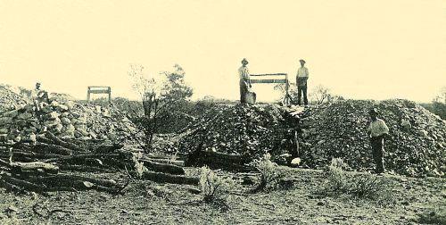
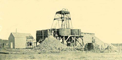

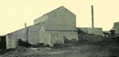

Mount Ida in more recent times (c) Steve Mogridge
MOUNT JACKSON
Also known as JACKSON.
MOUNT MALCOLM
Early name for MALCOLM.
MOUNT MARGARET
Alternate name for CRAIGGIEMORE.
28 49' S 122 10' E
Located between Leonora and Laverton.
The name comes from a nearby hill named by John Forrest in 1869 after Margaret
Elvire Hamersley who he later married.
Gold was discovered here but the date is uncertain as it is listed as between the 1880s and 1892.
Town site gazetted in May 1897.
MOUNT MONGER
Located near BULONG
MOUNT MORGANS
28 46' S 122 03' E
71 km east north east of Leonora.
Gold discovered in 1896 by Lilley and his party.
Named after E. A. Morgans who later became Premier of Western Australia.
Gazetted in December 1899.
Mostly abandoned by 1937 the area has now been re-opened to mining.


MOUNT MORTIMER
Alternate name for MOUNT DAWSON.
23 1' S 116 33 ' E
Located near Mount Mortimer south of the Ashburton River.
MOUNT PALMER
Southeast of Southern Cross.
Originally had a population of 500.

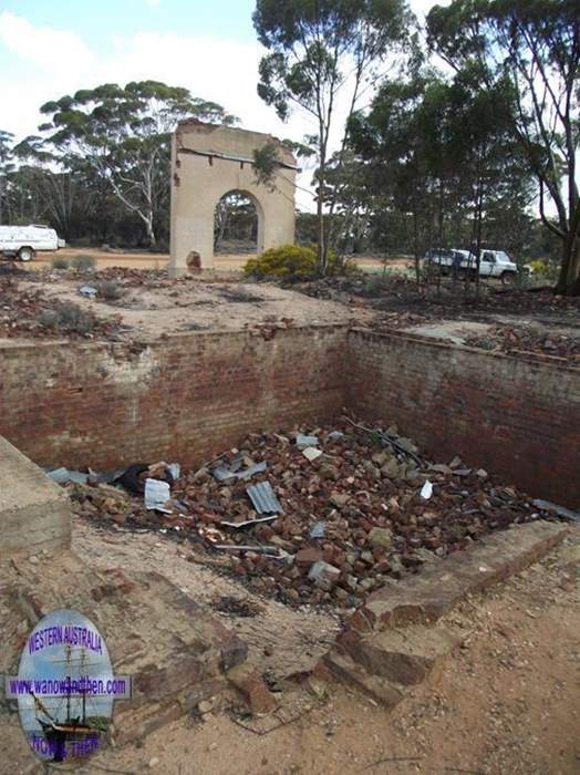
MOUNT SIR SAMUEL
see SIR SAMUEL
MOYAGEE
see NEDS WELL.
MUDDADA POOL
Alternate spelling of MUDDEDA POOL.
MUDDEDA POOL
Alternate spelling of MUDDADA POOL.
55 km east north east of Pindar.
MULGABBIE
Near Kurnalpi.
MULGARRIE
Previously known as HAYE'S FIND or HIT OR MISS.
30 23' S 121 30' E
40 km north of Kalgoorlie.
Gazetted in 1897
MULLINE
29 48' S 120 31' E
40 km west of Menzies
Gold discovered in mid 1890s.
Gazetted in 1897

State battery
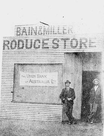
Store and Bank

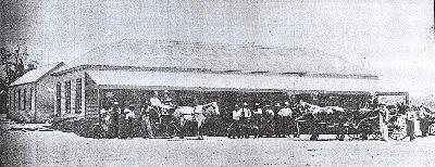
Victoria Hotel

MULWARRIE
Previously known as MOUNT HIGGINS.
30 00' S 120 33' E
50 km south west of Menzies.
Gold discovered by Paddy Higgins.
Gazetted in September 1900.
MUMMARRA
see STAKE WELL.
MUNARRA
see STAKE WELL.
MUNARRA GULLY
16 km from Nannine.
MUNBINNIA
Coach way station.
Abandoned by 1895
MUNGARI
30 51' S 121 17' E
16 km south west of Kalgoorlie on the old railway to Coolgardie.
Gazetted in December 1897 as Mungarri. Name changed to MUNNGARI in 1904. It was not until 1974 that MUNGARI was used.
A military training camp was located there in WWI
MUNGARRIE
Alternative spelling of MUNGARI.
MURRIN MURRIN
28 55' S 121 49' E
50 km east of Leonora.
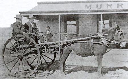
Hotel


Barber

Mine
MURRUM
Located on the old Yalgoo to Mount Magnet railway line.
Railway siding.
![]()
|
